FloPy is an open-source Python package developed by the USGS (Bakker et al., 2016). The primary functionality of FloPy is to support pre-and post-processing methods for the MODFLOW family of models, such as MODFLOW (Harbaugh et al., 2000), MT3DMS (Zheng and Wang, 1999), or SEAWAT (Guo and Langevin, 2002).

|
One of the primary motivations for development of the groundwater modeling component is to ensure that all steps are directly integrable into the existing cyberinfrastructure framework. This means the model should only depend on tools that can be seamlessly implemented in the Python environment, so that the workflow from raw data to model results can be achieved with one mouse click.
|
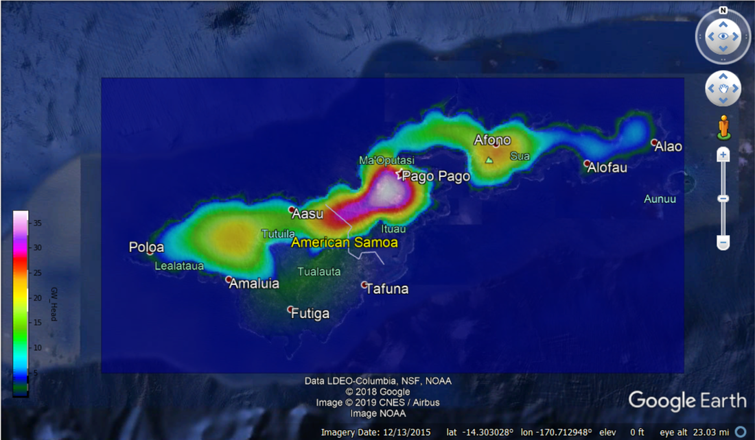
Example groundwater head distribution from uncalibrated model. Note does not reflect actual head distribution, for example purposes only. click image to download interactive Google Earth .kml map. (to open in Google Earth desktop)
|
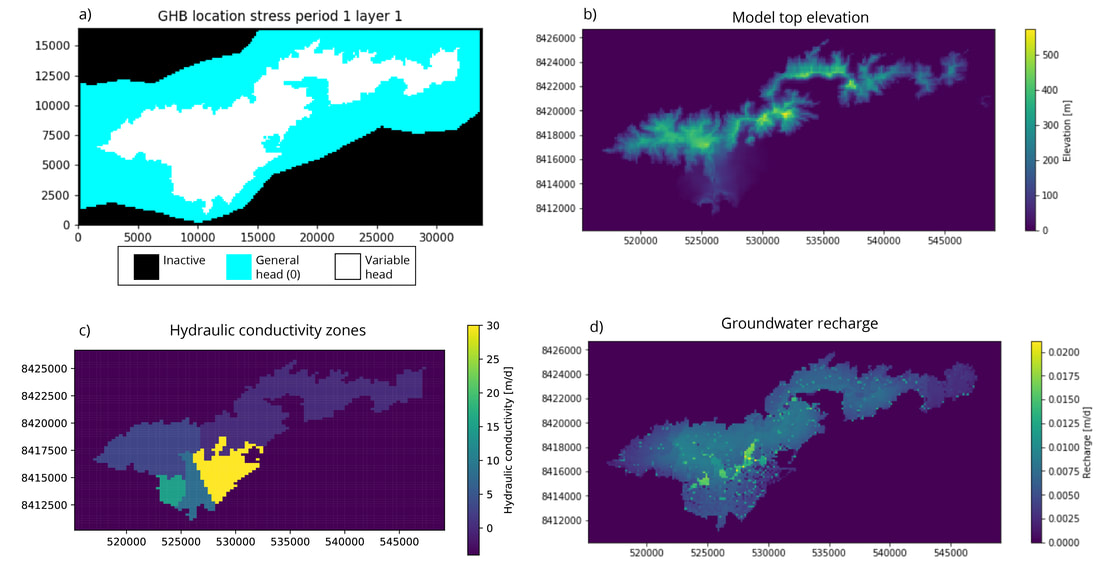
Examples of FloPy input datasets Including Head boundaries, model elevations, hydraulic conductivity zone definition, and recharge
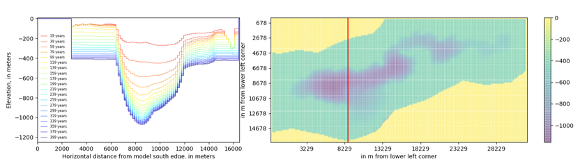
Please also note that this iteration of the Tutuila model workflow is presented as an example / proof-of-concept only. Any results presented here are not necessarily accurate or representative of reality, due to the need for additional constraint on many of the model parameters.
|
Ultimately the modeling framework developed for this project integrates weather station data, streamflow data, water budget modeling, and groundwater modeling into a seamless data-to-model workflow. The workflow is made entirely open-source, reproducible, and dynamic by using innovative cloud-computing tools such as Jupyter Notebooks, GitHub, and Binder/Azure.
These tools manage the data-science infrastructure, so the project team can focus on communicating with each other and developing models that are scientifically relevant and useful for water resources management. While this framework was deployed in American Samoa it could be easily scaled to other islands or localities. This work is still evolving and due to its dynamic nature will continue to do so as the process teaches us more about the hydrogeology of American Samoa. Please consider this website, and all of its contents to be like your DIY home remodel, always under construction! |
References:
Guo, W., & Langevin, C. D. (2002). User's guide to SEAWAT; a computer program for simulation of three-dimensional variable-density ground-water flow (No. 06-A7).
Moran, T. (2016). Projecting Forward: A framework for groundwater model development under the Sustainable Groundwater Management Act. Stanford Water in the West, Stanford Law School.
Harbaugh, A. W., Banta, E. R., Hill, M. C., & McDonald, M. G. (2000). MODFLOW-2000, The U. S. Geological Survey Modular Ground-Water Model-User Guide to Modularization Concepts and the Ground-Water Flow Process. Open-file Report. U. S. Geological Survey, (92), 134.
Zheng, C., & Wang, P. P. (1999). MT3DMS: a modular three-dimensional multispecies transport model for simulation of advection, dispersion, and chemical reactions of contaminants in groundwater systems; documentation and user's guide. Alabama Univ University.
