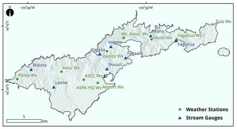
Because of the data gap created in 2008 when the USGS left American Samoa, historical, spatially-distributed rainfall and weather parameter data was becoming more and more outdated. To address this need and to supply data for our modeling purposes, starting in 2015 UHWRRC and ASPA worked collaboratively to develop and maintain a network of seven weather stations and eight stream gauges throughout the island
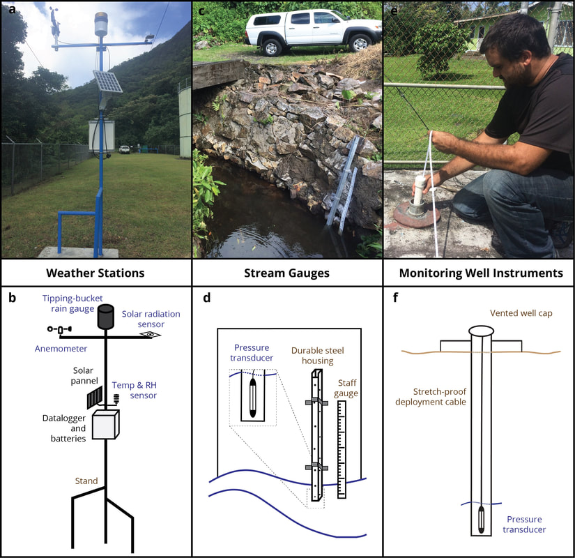
Examples of ASPA-UHWRRC weather station, stream gauge, and monitoring well network instruments with schematics. Weather stations (a and b) were initially deployed in 2015, Stream gauge site installation (c and d) began in 2016. General design of monitoring well instruments are shown in panels e and f. Blue text on schematics indicates sensors and brown text indicates infrastructure used.
|
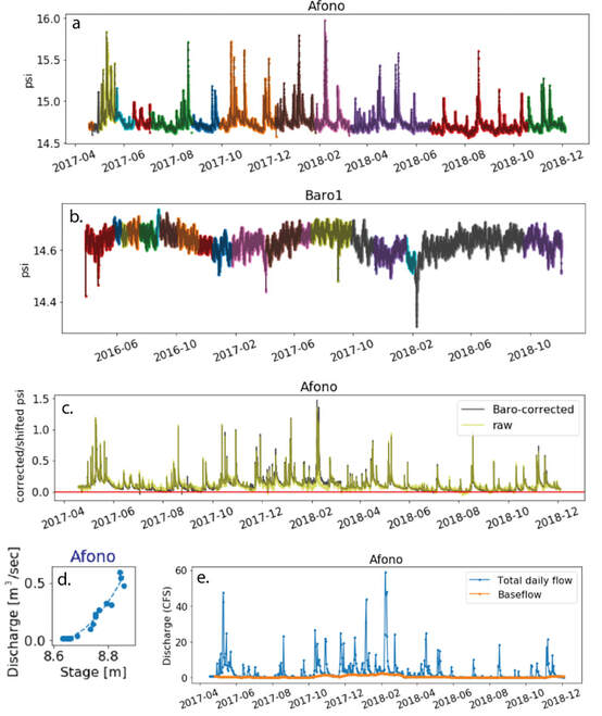
Example visualizations for a selection of the procedures implemented in streamflow processing for the Afono Stream Gauge. Steps include but are not limited to, a) consolidation of individual downloaded files (each color represents an individual data file) b) consolidation and incorporation of barometer data (each color represents an individual data file) c) barometric correction of stream stage, d) rating curve calculation, and e) baseflow separation.
Click on the links below to download: - Code for processing data - Raw streamflow data files - Processed data files. processed data is formatted by: - Daily data summarized by station - Monthly data for all stations - Annual average stream flows for all stations |
|
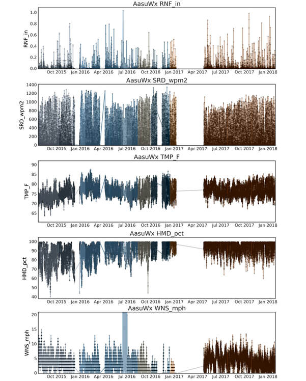
Example of consolidated weather station data for one of the ASPA-UHWRRC weather stations (Aasu site). Black line and dots represent consolidated data and colored shaded lines indicate extent of each individual raw weather station data file downloaded by ASPA technician.
Click on the links below to download: - Code for processing data - Raw weather data files - Processed data files. |
|
